
Surviving the Mumbai Monsoon Commute: Waterlogging, Trains and Rain-Day Essentials
A practical Mumbai monsoon commute guide: which line floods first, waterlogging junctions to route around, IMD alerts, live updates and a rain-day bag.
'%3E%3Crect%20width%3D'96'%20height%3D'96'%20fill%3D'%23E65100'%2F%3E%3Ccircle%20cx%3D'30'%20cy%3D'24'%20r%3D'44'%20fill%3D'%23fff'%20opacity%3D'.12'%2F%3E%3Ccircle%20cx%3D'60'%20cy%3D'74'%20r%3D'40'%20fill%3D'%23000'%20opacity%3D'.10'%2F%3E%3C%2Fg%3E%3Cg%3E%3Ccircle%20cx%3D'48'%20cy%3D'48'%20r%3D'15'%20fill%3D'none'%20stroke%3D'%23fff'%20stroke-width%3D'3'%2F%3E%3Cpath%20fill%3D'%23fff'%20d%3D'M48%2037%20l3.5%2011%20-3.5%2011%20-3.5%20-11%20z'%2F%3E%3Ccircle%20cx%3D'48'%20cy%3D'48'%20r%3D'2.2'%20fill%3D'%23fff'%2F%3E%3C%2Fg%3E%3C%2Fsvg%3E)
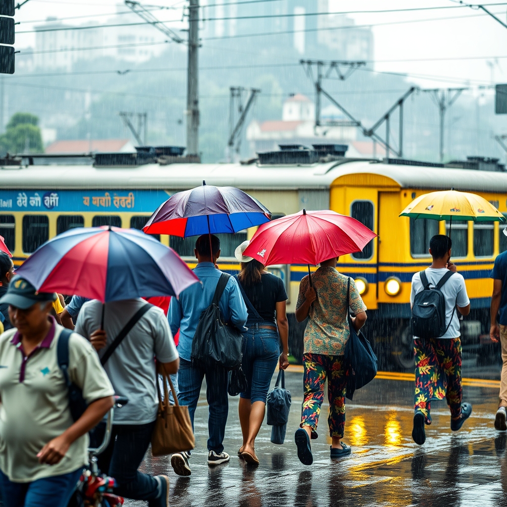
Every Mumbaikar learns the monsoon commute the hard way: one soaked shirt, one stranded local, one waist-deep subway at a time. The rains between June and September don’t just wet the city; they rearrange it, deciding which trains run, which roads vanish and which of your usual routes becomes a wading pool by lunchtime. This is the guide I wish someone had handed me on my first wet July: how to read a rain day before you leave home, which stretches to route around, what to keep in your bag, and where to look when everything is running late.
Rain-day decision table
| IMD alert | Rain in 24h | What it means | Your move |
|---|---|---|---|
| Yellow | 64.5–115.5 mm | Be aware; slippery roads, minor delay | Go, but leave buffer |
| Orange | 115.6–204.4 mm | Street flooding, stalled transport | Leave early or shift plans |
| Red | Over 204.5 mm | City likely to seize up | Work from home if you can |
Read the day before you step out
Before anything else, learn to read two numbers: the IMD alert colour and the day’s high tide.
The India Meteorological Department grades rain days by colour. A yellow alert means be aware: slippery roads, some delay. Orange is the one to take seriously; expect street flooding, fallen trees and stalled transport, so leave early or shift your plans. Red means the city is likely to seize up. If you can work from home or delay, do. On the worst mornings the BMC and the state simply advise people to stay in, and schools and colleges are shut.
The tide matters just as much as the rain. Mumbai’s storm drains empty into the sea, so when a heavy downpour lines up with a high tide of around 4.2 to 4.5 metres, the rainwater has nowhere to go and backs up onto roads and tracks. Tide timings are published daily in the papers and by the BMC. If a big downpour is forecast to coincide with the afternoon high tide, that is the window to avoid being out in it.
The trains: which line floods first
The suburban local is the spine of the commute, and in the rains the three lines behave very differently.
The Central line is the vulnerable one. The low-lying stretch through Matunga, Sion, Kurla and Chunabhatti, along with Wadala on the Harbour line, is the first to go under, and when the water crosses the rails, services between CSMT and Thane can slow to a crawl or stop outright. On heavy mornings, trains routinely run 25–30 minutes late well before any full halt, and recovery waits on pumps clearing the water at Kurla and Dadar. In the ghats beyond, the Karjat–Lonavala section is landslide-prone, and long-distance trains there stop altogether after a slip.
The Western line is your better bet in a downpour. It sits higher and generally keeps running with 10–15 minute delays where the Central line stops dead. Its weak points are the approaches at Andheri and the low patches near Bandra, but the corridor as a whole recovers faster. If you have any flexibility in your route, favour Western on a red-alert day.
The Metro is the quiet hero of the monsoon. Because Lines 1, 2A, 3 and 7 run elevated or underground, they keep moving when surface roads and even the locals founder. The catch is the last mile: the elevated stations stay dry, but the approach roads and the feeder autos that get you to them may not. Treat the Metro as your reliable middle leg and plan for a wet walk at either end.
The junctions to route around
These are the chronic flood points: not places to visit, but places to know so you can plan around them. Every one goes under within an hour of heavy rain, especially at high tide.
Hindmata, Dadar–Parel
On Dr Ambedkar Road between Dadar and Parel, Hindmata sits in a natural bowl and is the city’s most notorious flooding point, going waist-deep despite the BMC’s underground holding tanks. Why know it: it swamps fast and stalls every bus and cab through it. Tip: on a red-alert day don’t drive or wade it. Reroute via Dadar station on foot and take the train.
Gandhi Market and King’s Circle, Matunga
The King’s Circle–Gandhi Market pocket floods almost every heavy spell, worsened when the dewatering pumps run short. Why know it: it cuts off a busy junction linking Matunga, Sion and Wadala. Tip: King’s Circle station is on the Harbour line, which itself floods here, so cross-check before relying on it and keep the Central main line or a Metro option as backup.
Andheri Subway and Milan Subway
These east–west underpasses are among the first to shut, water pooling several feet deep with vehicles stalling inside. Andheri Subway sits beside Andheri station; Milan Subway links Santacruz east and west. Why know it: when they close, so does your quickest crossing. Tip: if you only need to cross the tracks on foot, use the station foot-over-bridge or skywalk, which stays open when the subway has become a swimming pool. Malad Subway behaves the same way.
Nehru Nagar and the Kurla low grounds
The Kurla belt (Nehru Nagar, the LBS Marg stretch) and Postal Colony in Chembur pond up quickly and snarl both the road and the Central line beside them. Why know it: it is the single biggest reason a Central line commute collapses. Tip: never board a train heading into a section already waterlogged; being stranded between stations is the worst place to be.
When the trains fail: buses, Metro and patience
On a bad day the BEST bus is a mixed rescue. In a single heavy spell the undertaking has diverted around 98 routes and seen scores of buses develop rain-related faults, with worst-hit pockets at Andheri, Malad, Bhandup, Antop Hill, Colaba and Mazgaon; state MSRTC services cancelled thousands of trips in the same stretch. Buses keep running on alternate routes until roads clear, so they are worth trying, but check before you count on one.
The practical hierarchy on a red-alert morning: Metro first where it serves your route, Western line over Central, BEST bus as a flexible fallback, and a shared cab or auto only with cash in hand and low expectations of speed. Above all, build slack into everything. Do not plan tight connections, and treat any fixed appointment as movable.
Where to look: live-update sources
Do not guess; check. Keep these to hand:
- m-Indicator, the Mumbai local app, for timetables, platform info and live-ish status across Central, Western and Harbour lines. It is the commuter’s default despite a dated interface.
- The railways’ own handles on X, @WesternRly and @Central_Railway, which post section-by-section delays and suspensions during heavy rain.
- Mumbai Traffic Police on X for road closures and diverted stretches.
- The BMC / MCGM Disaster Management channels (dm.mcgm.gov.in) and the IMD’s Mumbai warnings for alerts and tide timings.
- The BMC helpline, 1916, staffed round the clock from the disaster control room for fallen trees, flooding and emergencies. Save it in your phone now.
The rain-day bag: a checklist
Pack this once in early June and leave it packed:
- A proper full-length umbrella on a steel frame, not a flimsy two-fold that inverts on the first gust. Mumbai’s oldest umbrella house, Ebrahim Currim & Sons (the Stag brand), on S. Gandhi Marg near Marine Lines, is the place for one that survives a squall: roughly Rs 300 to over Rs 1,000. A light poncho or raincoat as backup earns its keep.
- A phone-and-documents dry pouch. Crawford Market’s rainwear wholesalers near CSMT sell roll-top and zip-lock pouches for about Rs 100–300; on a jammed local a flat pouch keeps your phone far drier than any pocket. Ponchos there start around Rs 150.
- Quick-dry footwear or gumboots. Carry your office shoes and wade in rubber. Hill Road shops in Bandra such as La Judi keep gumboots (around Rs 650) in stock deeper into the season than most; buy a size up for thick socks.
- A spare set of socks, a small towel and cash. Cards and UPI fail when networks drop; a few hundred rupees in notes gets you a bus or a share-cab when nothing else works.
A word on safety
Do not wade a flooded road. Hidden open manholes and stalled vehicles make it genuinely dangerous, and standing water rises faster than it looks. Route around known spots like Hindmata, the Andheri and Milan subways and the Kurla low grounds rather than through them. If you are caught out, head for high ground and a station foot-over-bridge, not an underpass. And never board a train pushing into a section that is already under water.
The Mumbai monsoon commute is survivable, even enjoyable, once you stop fighting it and start reading it. Check the alert colour and the tide before you leave, favour the Western line and the Metro over the flood-prone Central, keep 1916 and the railway handles on your phone, and carry a bag that assumes you’ll get wet. Give yourself extra time, never wade a flooded subway, and let the rain reset the pace. Do that, and the worst it costs you is a damp shirt and a good story, which in this city is practically a season ticket.
Frequently Asked Questions
Which train line should I take on a heavy-rain day in Mumbai?
Favour the Western line or the Metro. The Central line's Sion–Kurla–Chunabhatti stretch floods first and can be suspended entirely, while the Metro runs elevated or underground and keeps moving.
What do the IMD rain alert colours mean?
Yellow is be-aware (64.5–115.5 mm in 24 hours), orange is take-it-seriously with likely street flooding (115.6–204.4 mm), and red is stay-in-if-you-can (over 204.5 mm).
Why does Mumbai flood so badly on some days and not others?
The tide. When heavy rain coincides with a high tide of around 4.2–4.5 metres, the storm drains can't empty into the sea and water backs up onto roads and tracks. Check the day's tide alongside the forecast.
What is the one emergency number I should save?
The BMC disaster helpline, 1916, staffed round the clock from the control room for waterlogging, fallen trees and flooding emergencies. Save it before the season starts.